The Ultimate Hiking Guide
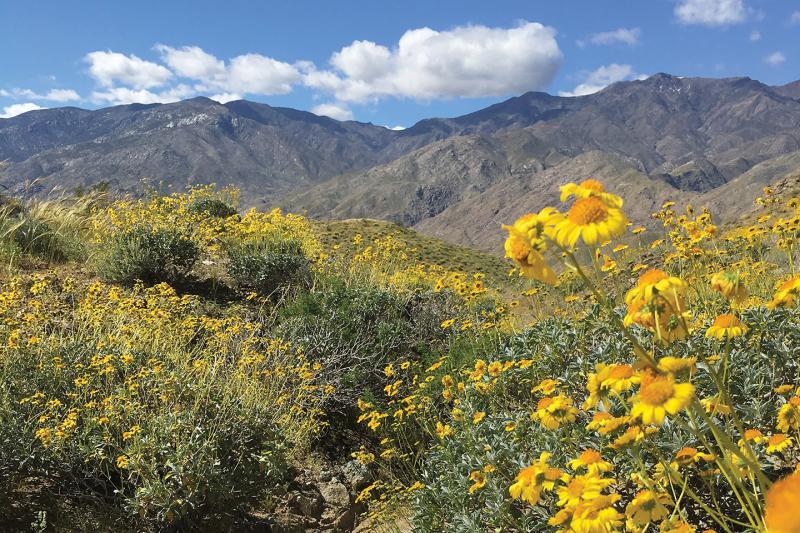
Palm Springs is one of Southern California’s premier hiking destinations, offering dramatic desert landscapes, palm-filled oases, rugged mountain ascents, and cultural heritage trails—all within minutes of downtown. Whether you’re a casual walker, an avid hiker, or chasing bucket-list climbs, this guide covers the best hiking trails in Palm Springs, organized by location and difficulty.
Why Palm Springs Is a Top Hiking Destination
Palm Springs offers three distinct hiking areas, each with its own terrain and experience:
- Trails Within the City of Palm Springs – Easily accessible urban-desert hikes with scenic overlooks
- Agua Caliente Indian Reservation (Indian Canyons & Tahquitz Canyon) – Palm oases, waterfalls, and cultural sites
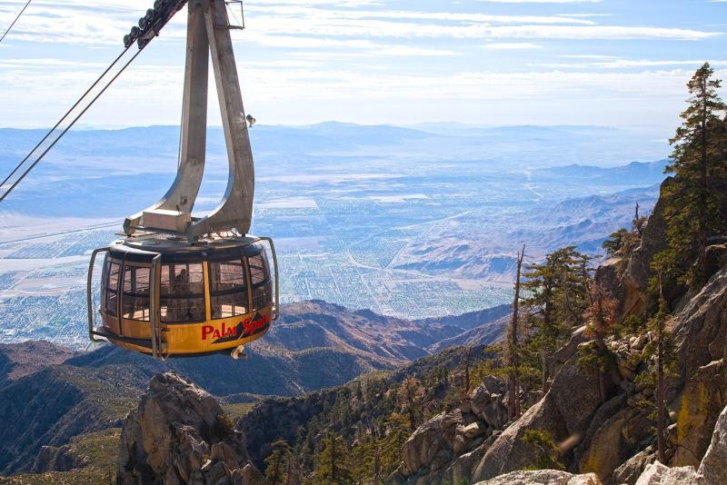
- Mount San Jacinto State Park – High-alpine wilderness accessed via the Palm Springs Aerial Tramway
Together, these areas offer more than 170 miles of trails, ranging from flat family walks to steep elevation gains.
Andreas Canyon
Trails Within the City of Palm Springs
These trails are free to access and ideal for visitors staying in downtown Palm Springs or South Palm Springs.
Araby Trail
Moderate | 4.1 miles | 1,404 feet elevation gain
Moderately trafficked out-and-back trail. The beginning of the trail goes above a residential area for about ¼ mile but offers great views, including Bob Hope’s house. The Araby trail can be accessed either at the entrance to the Rimcrest / Southridge development (that’s where Bob Hope’s house is… ) or via the Berns, Henderson, and Garstin Trails. If starting from the Rimcrest / Southridge Road, the trail can be found on the left (east) side of the road before you get to the guard gate.
Park in the dirt on the right side immediately after turning onto the Rimcrest/Southridge road.
Popular Variations:
- Araby West Loop (5.4 miles)
- Araby & Berns Loop (4.8 miles)
- Araby to Goat Hill (11.7 miles)
Credit: Drew Robinson
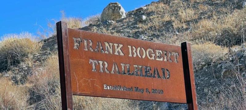
Bogert to Murray Hill
Moderate | 6.8 miles | 1,853 feet elevation gain
A classic South Palm Springs hike with rewarding panoramas. Start at the Frank Bogert trailhead at Andreas Hills Drive, which is at the end of a residential neighborhood. Stay right at the trail junctions even if Murray Peak isn’t clearly marked. The trail is open from sunrise to sunset.
Bogert to Wildhorse
Moderate | 3.8 miles | 900 feet elevation gain
Shorter but scenic, offering excellent views of Andreas Hills. Keep left when ascending. At the summit, enjoy 360-degree views of the Indian Canyons.
To access the trail, take South Palm Canyon Drive toward the Indian Canyons, turn left onto Bogert Trail, and park in the dirt lot at the end.
Credit: Linda Chavous
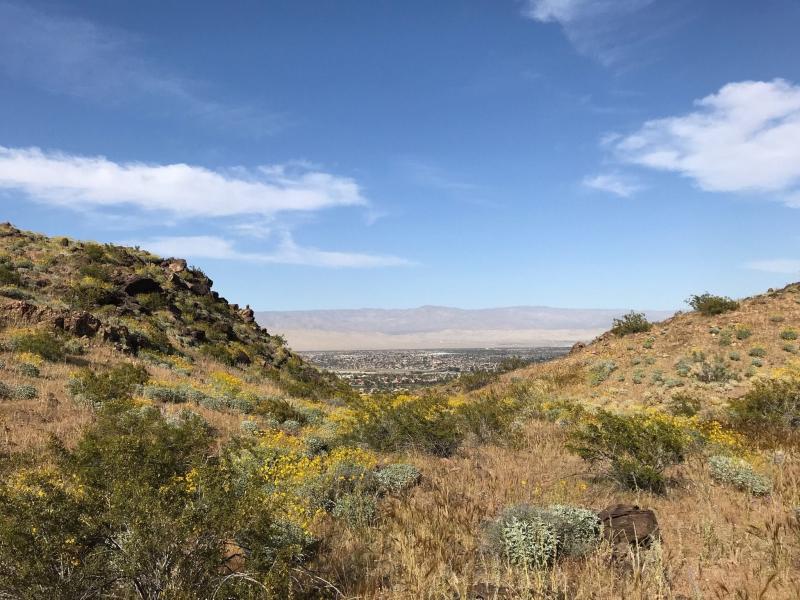
Goat Trails
Moderate | 3.2 miles | 770 feet elevation gain
Trailhead is off East Palm Canyon Drive by Von's at Rimcrest Plaza.
The Goat Trails are in the Oswit Canyon area and are known for their stunning views, cacti, rocks, and connecting routes like Araby and Murray Peak. The trail is primarily used for hiking, walking, trail running, and nature trips, and is accessible year-round. Dogs can also use this trail, but they must be kept on a leash. The trail begins on the dirt road on the east side of the shopping center. Climb .7 miles past the water tower, and the dirt road levels off. Near the top of the hill, you will see a driveway leading into the towers on your right. Just past this, you will see a single-track trail that rises sharply up a hill. Take this and continue on it until you reach a wider trail, which is actually an abandoned dirt road.
Credit All Trails
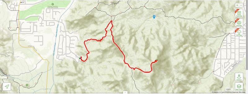
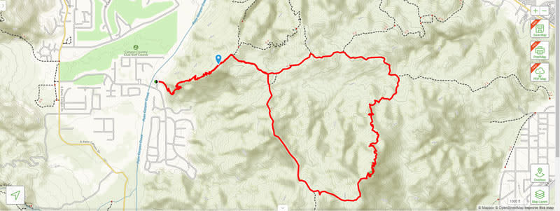
Murray Hill Loop Hike
Hard | 7.9 miles | 2,506 feet elevation gain
Follow Bogert Trail Road in South Palm Springs and turn left on Barona Road to access the trailhead. This is one of several trails on this hillside, offering panoramic views. You begin at the Garstin Trailhead and connect with the Clara Burgess Trail midway.
Murray Hill is a pyramid-shaped mountain in the Santa Rosa Mountains. As you climb, there will be a steep section and several switchbacks to help manage the incline. As soon as you begin to gain a little elevation, you will be greeted with views of the San Jacinto Peak to the west and Palm Springs to the North. The trail quickly levels out as you reach the summit. There are picnic tables with expansive views.
As you follow the sign for the Clara Burgess Trail, you will get your first views of Murray Peak.
Optional add-ons include:
- Garstin Loop Trail (3.7 miles, moderate)
- Clara Burgess Trail to Murray Hill (7.1 miles)
Murray Hill. Credit David Lockeretz
Museum Trail
Moderate | 2 miles | 920 feet elevation gain
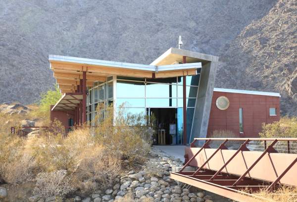
Park at the public parking structure in front of the Palm Springs Art Museum at 101 N Belardo Road.
A short but steep trail starting behind the Palm Springs Art Museum, perfect for families or a quick scenic hike downtown. You will climb up a rocky and steep slope, covering almost 1,000 vertical feet, and at the top, you will be rewarded with panoramic views of Palm Springs. That's O'Donnell Golf Course and Club immediately below. Picnic tables await you at the top for a rest and refresh.

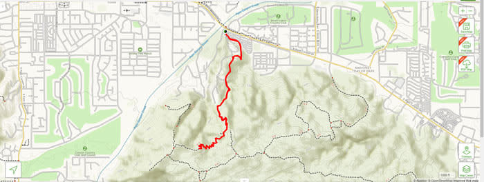
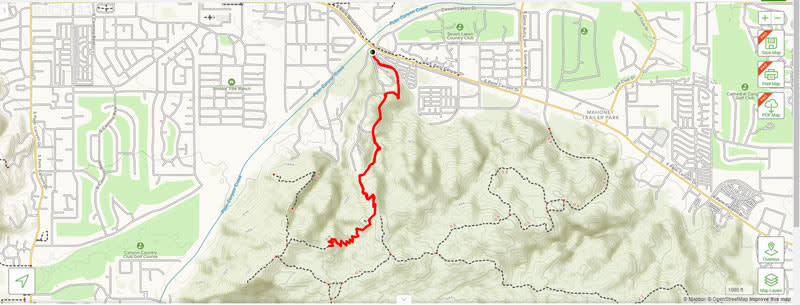
North Lykken Trail
Moderate | 4.5 miles (round trip) | 1,748 elevation gain
The North Lykken Trail can be accessed from the west end of Ramon Road. Follow Ramon Road till it ends at the mountain, and you will see the trailhead off to the right. Park on the side street off Ramon Road. A steady climb with classic Palm Springs views. Pet-friendly.
As you climb, you will be greeted with a 180-degree cityscape view. At 1.6 miles, turn right at an obvious fork, and you will begin your descent on Museum Trail. Your trail ends at the Palm Springs Art Museum. If you don't want to hike the trail back, walk down Belardo to Ramon, then turn right to return to your vehicle.
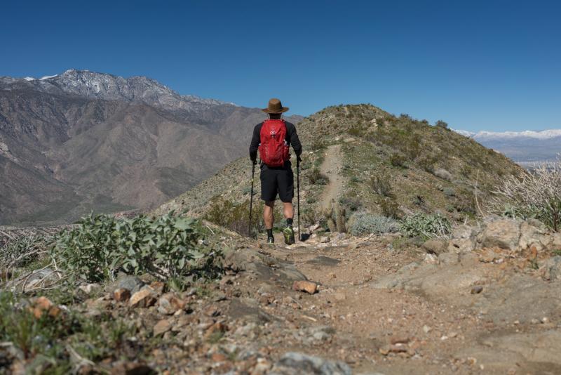
Skyline Trail: Cactus to Clouds
Hard | 17.5 miles | 10,577 feet elevation gain
This epic day hike starts in the desert behind the Palm Springs Art Museum and ends on top of Mt. San Jacinto at 10,834 feet. Do not attempt during the summer or in hot weather. You gain over 8,000 feet in the first 12 miles, which is achieved by hiking in dry, arid desert conditions. When fully prepared, hikers can experience one of the most diverse hikes, with views unlike any other. This trail is nearly always completed by returning from the peak to the Palm Springs Aerial Tramway's upper station. Please note that there is a fee for using the tram.
South Lykken Trail
Moderate | 7.3 miles | 2,257 ft elevation gain
Runs between Mesquite Avenue and South Palm Canyon Drive (North trailhead). Parking is available on Mesquite and the surrounding side streets. The trailhead is located just before the Tahquitz Canyon Visitor Center.
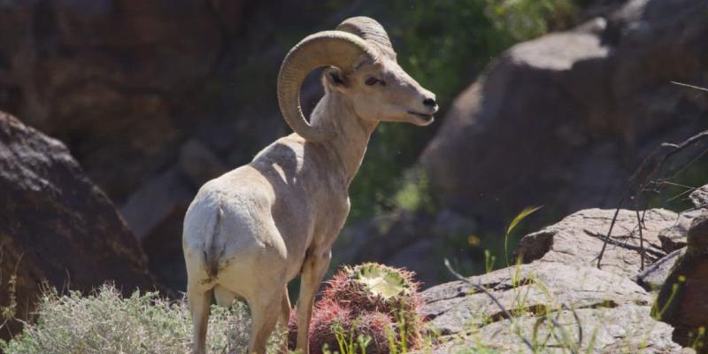
As you begin the South Lykken trail, you are immediately presented with panoramic views of downtown Palm Springs. The first picnic stop has an elevation of more than 1,000 feet. Look for bighorn sheep sightings and expect rocky terrain. If you see bighorn sheep, please be respectful by maintaining an appropriate distance and admiring them from a distance so you don’t disturb them.
This trail is sun-facing in the morning and much of the afternoon, so there’s little to no shade. Please remember a hat and sunscreen, and always bring more water than you think you will need, even when hiking in cooler temperatures.
Credit Rob Bignell
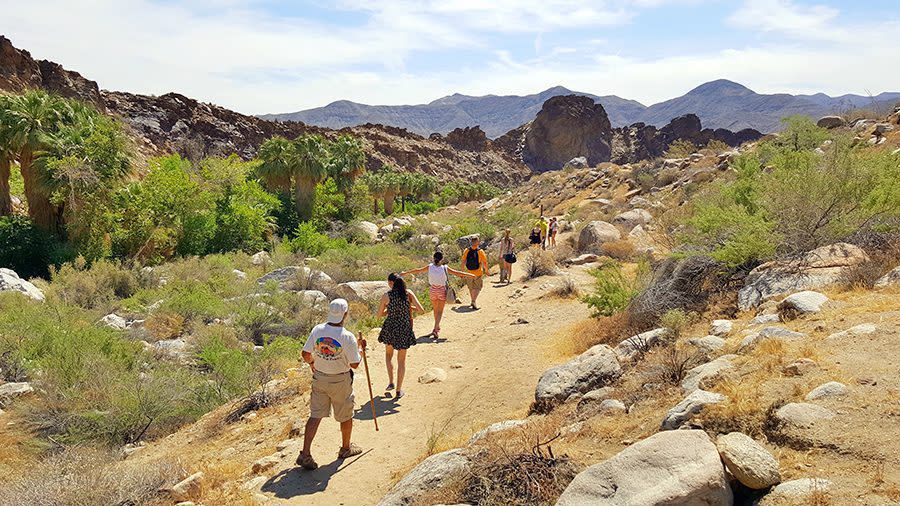
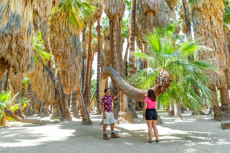
Indian Canyons
(Agua Caliente Reservation)
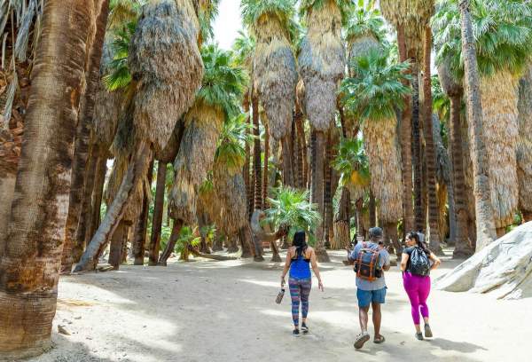
Indian Canyon comprises Andreas Canyon, Murray Canyon, and Palm Canyon. Located just minutes from downtown, these sacred canyons offer palm groves, streams, waterfalls, and cultural history. From October to June, there are free ranger-led interpretive hikes or talks for families to learn more about the natural landscape and history of the Agua Caliente Indian people.
Fee: $9 adult entry
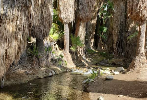
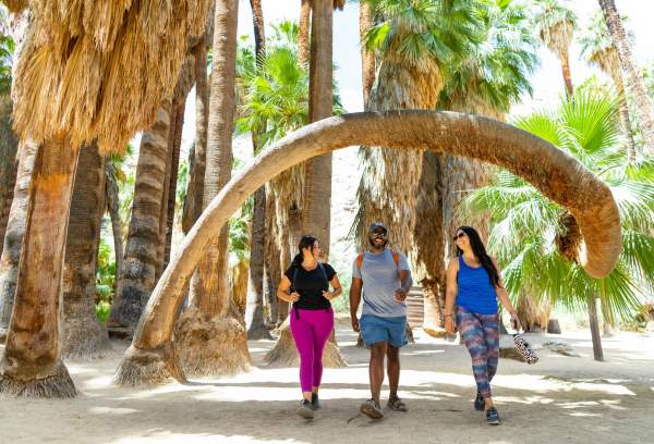
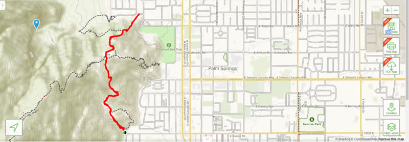
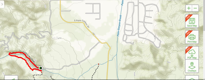
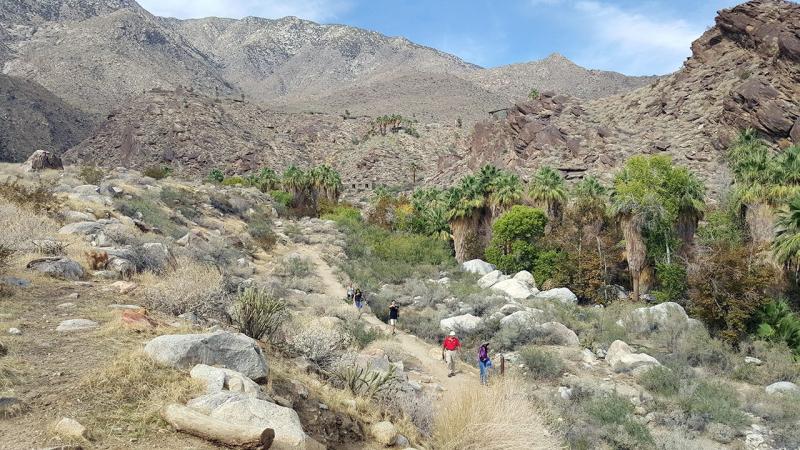
Andreas Canyon
Easy |1 mile |173 feet elevation gain
This heavily trafficked hike features a natural stream and a walk through one of the largest fan palm groves in the U.S. When you enter the canyons, take the first road to the right to reach the parking lot and trailhead.
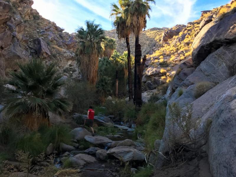
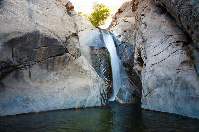
Murray Canyon - Trail to Seven Falls
Moderate |3.7 miles |600 feet elevation gain
This is part of Indian Canyons and is a heavily trafficked out-and-back trail featuring a waterfall. It is primarily used for hiking and horses.
Guide to the Coffman Trail in Murray Canyon
Get the Complete Trail Guide to Hiking in Indian Canyons
Credit Casey Schreiner
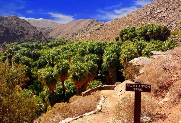
Palm Canyon Trail
Easy |2.0 miles | 295 feet elevation gain
This is an excellent hike with picnic areas near a creek. Accessed from the trading post in Indian Canyons, this trail is shaded with a mile of fan palms along both sides of a stream. See incredible rock formations.
Palm Canyon: Exploring the World's Largest Reserve of Desert Fan Palms
Tahquitz Canyon
Loop Trail
Easy |1.7 miles, 291 feet elevation gain
This trail starts at the end of Mesquite Ave. before arriving at the Tahquitz Canyon Trailhead. It is on the reservation land of the Agua Caliente Indians. It features a waterfall, is a heavily trafficked loop, and is suitable for all skill levels. There is an entry fee.
Learn more: Discover Tahquitz Canyon
Mt. San Jacinto State Park
Mount San Jacinto stands 10,834 feet above sea level and is the second-highest mountain range in Southern California. Mt. San Jacinto State Park offers 54 miles of hiking trails located within a 13,000-acre pristine wilderness, one of the last in California. Trails can be accessed at the Palm Springs Aerial Tramway’s Mountain Station.
Guide to Hiking Mt. San Jacinto Peak Trail
Hiking Jean Peak from the Palm Springs Aerial Tramway
From palm-lined oasis trails to skyline-defining ascents, Palm Springs offers some of the most diverse hiking experiences in California. Whether you’re seeking an easy nature walk, a moderate scenic climb, or a legendary endurance hike, these best hiking trails in Palm Springs deliver unforgettable desert adventure.
Hiking Tips for Palm Springs
- Best Season: October–April
- Start Early: Especially in warmer months
- Bring Water: More than you think you need
- Check Conditions: Heat advisories matter
- Know Fees: Indian Canyons, Tahquitz Canyon, and Palm Springs Aerial Tramway require entry tickets
FAQ: Frequently Asked Questions About Hiking in Palm Springs
When is the best time of year to hike in Palm Springs?
The best hiking season in Palm Springs is October through April, when daytime temperatures are cooler. Summer hiking is recommended only very early in the morning or at higher elevations, such as Mount San Jacinto State Park, accessible via the Palm Springs Aerial Tramway.
Are Palm Springs hiking trails free?
Many trails within the City of Palm Springs are free, including Araby Trail, Lykken Trails, and Museum Trail.
Are dogs allowed on hiking trails in Palm Springs?
Dogs are not permitted on trails within Indian Canyons, Tahquitz Canyon, Mount San Jacinto State Park, or most trails. Always check posted signage before hiking.
Is hiking in Palm Springs safe?
Yes, hiking in Palm Springs is safe when you’re prepared. Always bring plenty of water, start early, wear sun protection, and avoid hiking during extreme heat. Some trails are remote and steep, so choose routes appropriate for your skill level.
Are there easy or family-friendly hikes in Palm Springs?
Yes. Easy, family-friendly hikes include Museum Trail, Andreas Canyon, Palm Canyon Trail, and Tahquitz Canyon Loop, all of which offer scenic views without significant elevation gain.
Explore More: